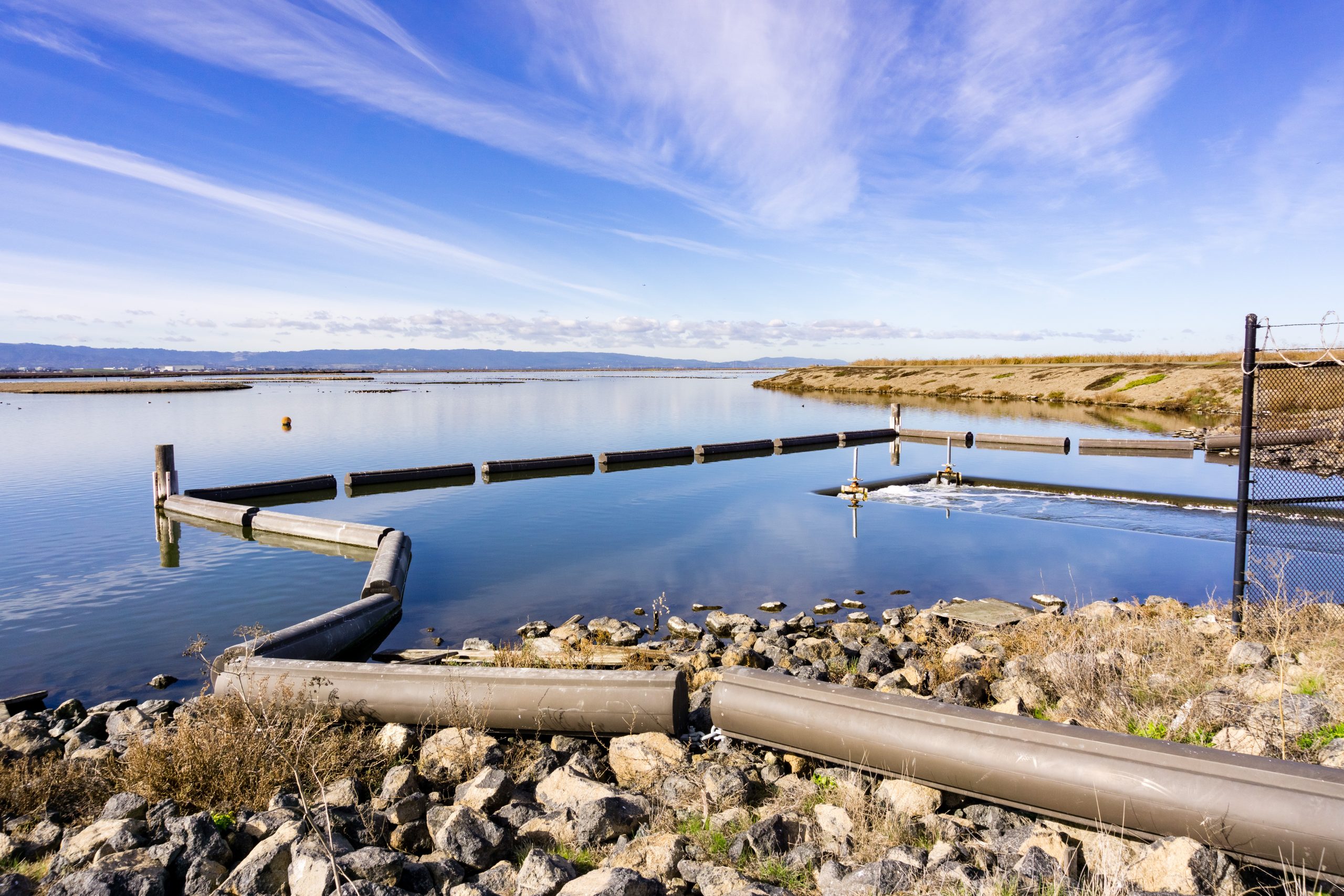
Open water flood control gate, Alviso, San Jose, south San Francisco bay, California. Adobe Stock.
Scientists lead the charge for equity in flood risk mitigation
As California grapples with the aftermath of flooding events, scientists are taking proactive steps to develop modeling frameworks that increase transparency for managing flood risk. Led by University of Florida geoscientist Katy Serafin, and co-authored by a team of researchers from Stanford University, a new methodology published in Environmental Research Letters merges flood modeling with comprehensive involvement from community partners and encourages cooperation among researchers, local stakeholders, and decision-makers.
Communities nationwide are dealing with flooding issues, whether due to atmospheric rivers, hurricanes, or rising sea levels. Those positioned along rivers outletting to the coast face a compounding issue: the potential for coastal and inland processes to combine and exacerbate flooding events. The deluge of water caused by powerful atmospheric phenomena has taken a toll on California, leading to losses exceeding $4.6 billion in damages in 2023 alone. While this collaborative research began in 2018, its significance has only amplified in light of recent events.
Serafin and her team partnered with south San Francisco Bay region stakeholders to confront the potential for uneven impacts of mitigation projects proposed for San Francisquito Creek, an urban river flowing through the densely populated region. Once a natural floodplain, the area has undergone substantial urbanization, leading to challenges such as flooding, water supply issues, and sediment accumulation.
In the case of San Francisquito Creek, significant efforts have been made to update downstream infrastructure near the coast to prevent flood risk transfer from future upstream projects, and also to accommodate future sea level rise. However, there has been a lack of attention given to the potential changes in precipitation, which the team identified as a significant factor driving upstream flood risk.
To assess flooding hazards resulting from both inland and coastal processes, the researchers employed a hybrid modeling approach that combines statistical and physics-based modeling methods. This generates a large number of joint river discharges, coastal sea levels, and resulting water levels along the river. By coupling this approach with a commonly used flood model, the researchers were able to analyze the likelihood of floods occurring now and in the future, while also accounting for the uncertainties involved.

The team also developed location-specific flood risk trajectories, which emphasize the impact of future changes on vulnerable communities, rather than just the total risk of flooding. These findings show there is an interplay of uncertainty from running a range of conditions, climate change, and planned infrastructure modifications.
“Often when we are thinking about mitigating and adapting to future flooding along coastlines, we’re only considering one process like coastal-induced flooding and how this process may change,” Serafin said. “Our work shows that infrastructure planning with only one of the processes in mind could still leave vulnerabilities along the river.”
The authors pointed out that updates to aging flood-mitigation infrastructure and the impacts of climate change could disproportionately increase flood risk for various communities, underscoring the difficulties in achieving fair flood-risk mitigation. Traditional approaches that focus on the benefits of infrastructure projects for individual events overlook the nuanced impacts on communities along rivers.
According to the authors, identifying inequities associated with infrastructure projects is now legally required by regional water boards in California, but tools are lacking for making this assessment systematically.
Traditionally, flood mitigation infrastructure including levees and seawalls are designed to withstand rare events, such as the 100-year flood, which has an average 1% chance of occurring in any given year. However, when running millions of joint coastal and river discharge scenarios, the research team discovered that flood risks were still elevated downstream of the proposed infrastructure changes, which included widening a bridge, even though they were concealed by the evaluation of a 75-year event, based on the 1998 El Niño flood, the rare event used in the planning process.
By factoring in the potential impact of increasing precipitation and river flow events due to climate change, the risk of flooding further escalated. This raises concerns that the current acceptable level of risk may not remain acceptable in the coming decades.
The planning process and implementation are not always adaptable to the inclusion of new models, explains Serafin, as they often rely on trust and traditional practices. However, the project successfully incorporated components for capturing uncertainty into the existing models, allowing the results to be immediately integrated into ongoing planning efforts. Once the results were shared and discussed with San Fransciquito Creek’s managing agency, efforts were made to change project plans to reduce the risks for communities downstream.
“I think one of the important aspects here is that we prioritized actionable over abstract knowledge creation,” Serafin said. “By working with local communities who voiced concerns, and then having consistent dialogue with the governing agency and other state agencies, our research assisted in updating the project plans to eliminate the risk transfer by elevating the banks near the affected communities.”
The study’s findings provide a roadmap for advancing equity in flood-risk management not only in San Francisquito Creek but also in river communities across California and beyond. By prioritizing engagement and adopting innovative approaches that include a wider range of factors contributing to flood risk, communities can work toward building a more resilient future.
“If we had just researched the subject, published it in an academic journal, and never talked with anyone about it, then it wouldn’t have had the same impact on the livelihoods of the people in the area,” Serafin said. “Designing research questions with communities and taking the time to build connections makes the research we do so much more relevant to people’s everyday lives.”
Read more about the study here.
DOI: 10.1088/1748-9326/ad3c58


