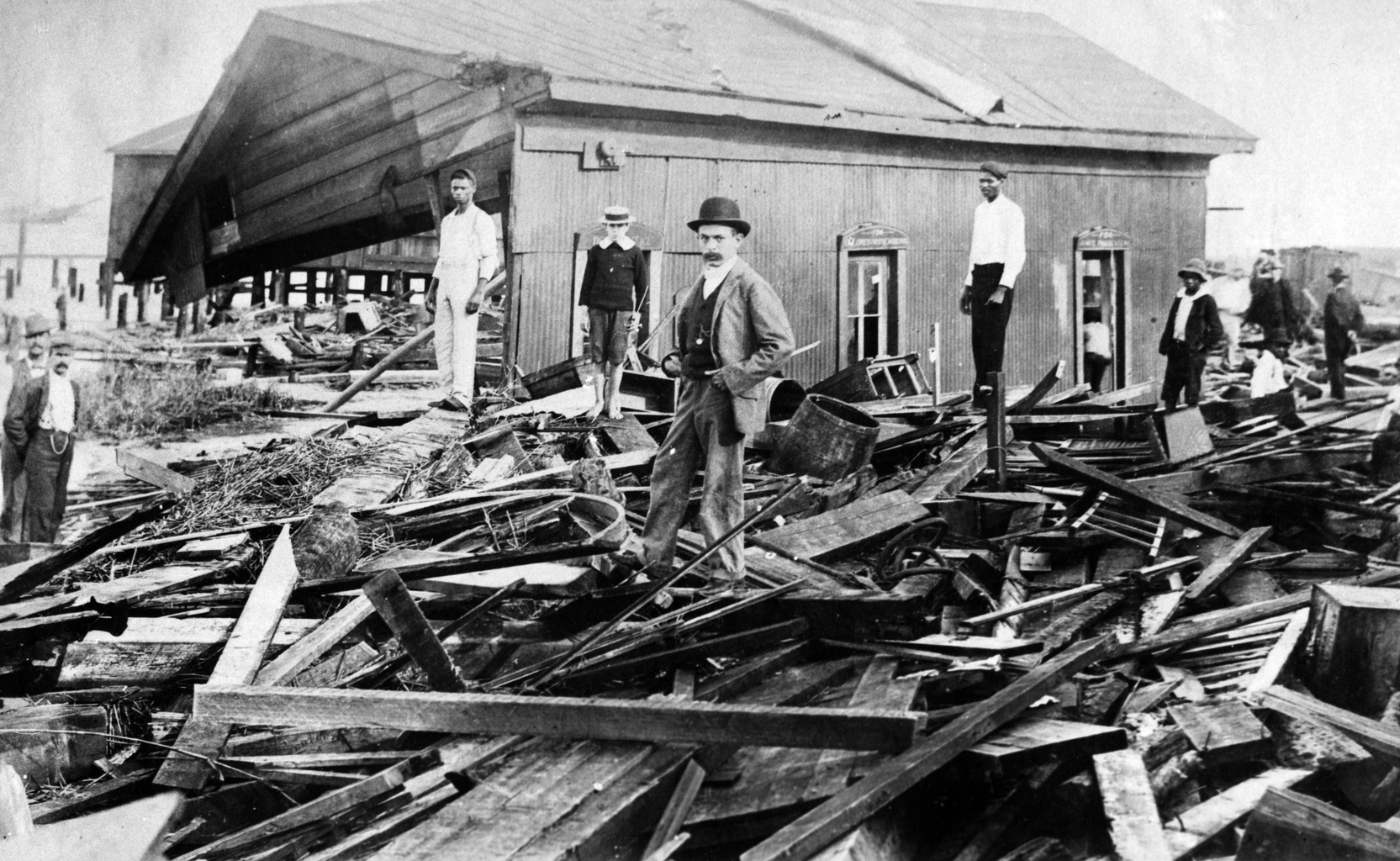
In Fernandina Beach, Florida, an example of the widespread destruction caused by the hurricane of 1896 that devastated Atsena Otie Key. (Courtsey of Florida Memory)
Lessons from Hurricanes Past
With the help of digital technology, UF professor plans to bring the history of a devastated town to the present
On September 29, 1896, the island of Atsena Otie Key was struck by a powerful hurricane. Located just off the coast of Cedar Key in the Gulf of Mexico, Atsena Otie Key was home to a world-renowned cedar mill and 50 families — until the resulting storm surge destroyed the mill, prompting a steady exodus from the island.
While devastating to industry in the area, it shouldn’t have come as much of a surprise. Just 54 years prior (and 26 years before the construction of the mill), the island, then serving as a U.S. Army headquarters, was struck by another hurricane. The damage was so severe that the government abandoned the post, considering it unsalvageable.
It raises the question: If there was recent evidence that a location was especially prone to strong hurricanes, why build a center of industry there? How could everyone forget so quickly?
This is an all-too-common problem that UF anthropologist and Hyatt and Cici Brown Professor of Florida Archaeology KENNETH E. SASSAMAN is trying to solve — with the help of some innovative technology.
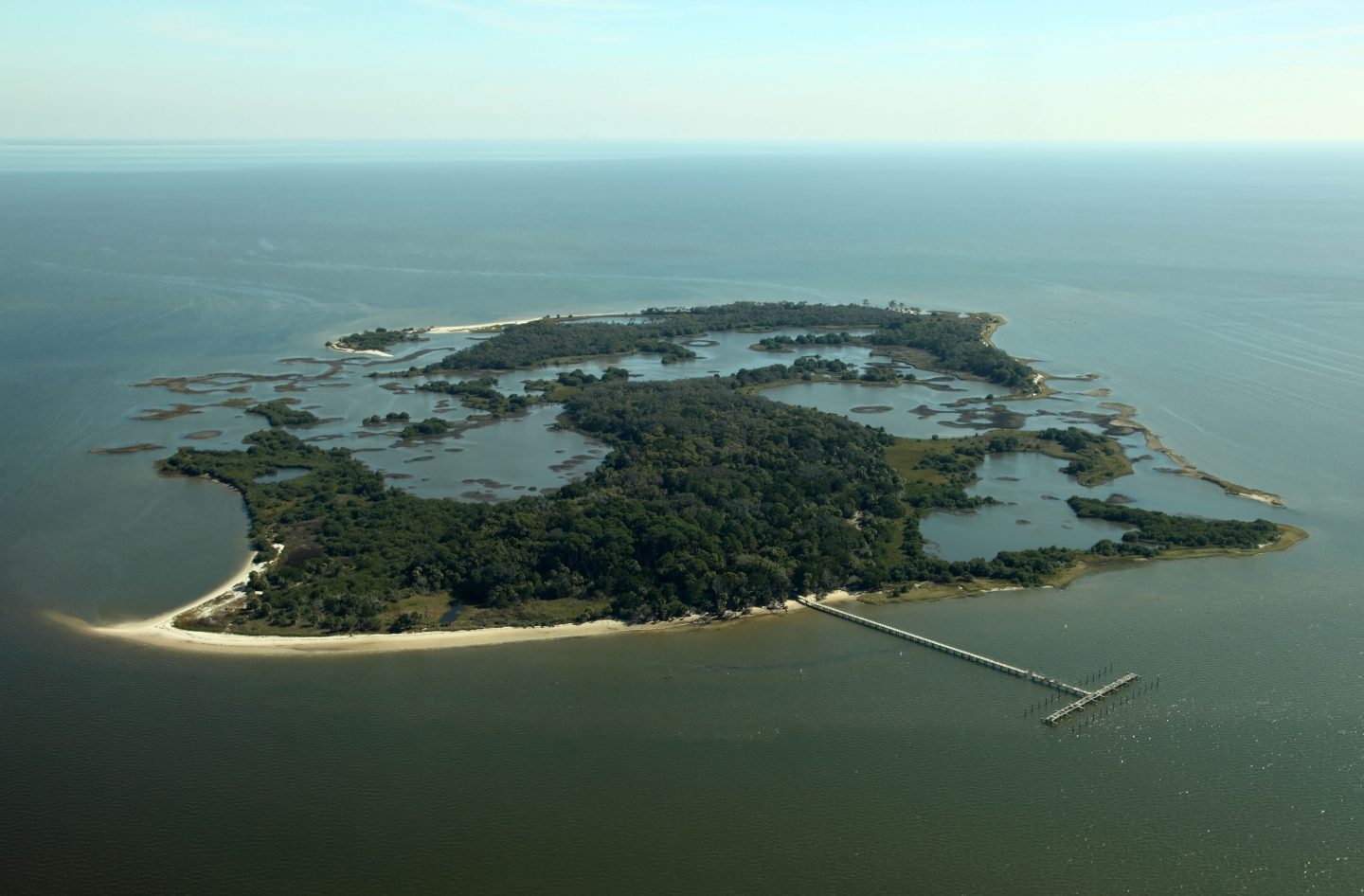
A specialist in the Archaic (8,000 to 1,000 BC) and Woodland (1,000 BC to 1000 AD) periods of the American Southeast, Sassaman has always been interested in how he can use history as a tool to guide policy and decision-making in the present.
Specifically, Sassaman wondered if he could use a historical precedent to show how climate change might affect Florida. To find out, he dug into Florida’s history of indigenous coastal dwelling going back more than 13,000 years, when sea-level was down 80 meters and the Gulf Coast lay more than 200 kilometers from its current position.
Sassaman hoped to offer insights on how indigenous groups adapted over thousands of years to drastic environmental changes that resembled present-day issues.
Unfortunately, this early history presented one huge problem he couldn’t work around.
“No matter how I spin it, no matter what the narrative is, if it’s that old, it doesn’t resonate with the present,” he said. “It’s too foreign. And the further back in time we go, the less empathy and connection people have to it.”
“We turn storms into the boogeyman.”
While venting these frustrations to a colleague one day, Sassaman happened to share the tale of Atsena Otie Key. Riveted, his colleague pointed out that Sassaman had the answer right in front of him.
Here was a wealth of recent information, including oral histories from those that lived through the 1896 hurricane, that would feel much more immediate to a modern audience. Yet there was still a major issue Sassaman knew he would have to contend with: presentation. A book or exhibit on the island’s unique past just wouldn’t have the impact Sassaman knew he’d need to get his argument across.
“History is not always accessible to people outside of academia,” he said. “It doesn’t appeal to their emotions or their visceral sense of personal connection.”
To address this, Sassaman formed a partnership with Digital Heritage Interactive (opens in new tab), a studio run by UF alumni that specializes in applying digital technologies to cultural resources, to create an interactive walkthrough of Atsena Otie Key. Sassaman ultimately hopes users will be able to navigate the town in virtual reality as it appeared in 1896, talk to real people who lived there before the hurricane and see the devastation the storm reaped for themselves.
“Part of this project is to make history sensory, emotional, personal and biographical,” Sassaman said. “It’s going to be the story of Velma Crevasse at age 11, living on Atsena Otie Key, waking up to the eye of the hurricane thinking the storm was over, only to turn around and see a wall of water approaching her and her house.”

The team is planning to have multiple time periods on the island built out, allowing viewers to move through different eras in a non-linear fashion to show how vulnerable this location was to storm surges and erosion. One minute a user could be in 1896, then suddenly jump to 1842, 1935 or 1950 — all years a hurricane struck the area.
“We turn storms into the boogeyman,” Sassaman explained, when, in reality, an at-risk area like Atsena Otie Key is what happens when a large storm and a human-made vulnerability crash into each other. Long before 1896, the cedar in the area had been overharvested, increasing the odds a storm surge could wreak havoc on the island. Sassaman hopes that being able to see the firsthand consequences of development in an area that has been destroyed by natural occurrences multiple times might encourage people to think harder before building in such an environment.
His partner, Digital Heritage Interactive (opens in new tab), is based in Orlando and run by two like-minded UF alumni with degrees in anthropology, DIANA GONZÁLEZ-TENNANT ’11, MA, and her husband EDWARD GONZÁLEZ-TENNANT ’11, PhD, who have previously developed digital walkthroughs of historic settlements. One of their previous projects, Rosewood (opens in new tab), allowed users to explore an African American town in Florida that was destroyed during a 1923 race riot.
“Atsena Otie Key and similar projects provide an engaging and interactive method for communicating two things with the public,” Edward said. “The first is an accurate picture of the incredible heritage resources located on the island. Second, the virtual reconstruction reveals the growing danger climate change poses for such resources. Once these resources are gone, they’re lost forever. This project lets us retrieve them from the dustbin of history.”
“The hope is to incite discussions about climate change, both past and present,” Diana said. “What made Atsena Otie Key vulnerable was not that the storm wiped it out, but that the storm drove industry away — that’s why the town no longer exists.”
“Part of this project is to make history sensory, emotional, personal
and biographical.”
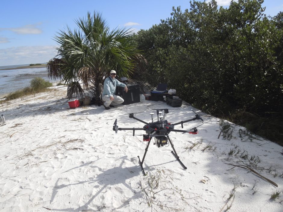
While this project is still in its early stages, some important early steps have already been completed. To re-create Atsena Otie Key, Sassaman and team began by working with the GatorEye Unmanned Flying Laboratory (opens in new tab) (GatorEye UFL), a drone program run by the Spatial Ecology and Conservation Lab at UF. GatorEye UFL scanned the island, uncovering the original foundations of buildings and allowing the team to match up what remains with historic maps of the town. This high-resolution mapping managed to accomplish in 40 minutes what previously might have taken Sassaman months.
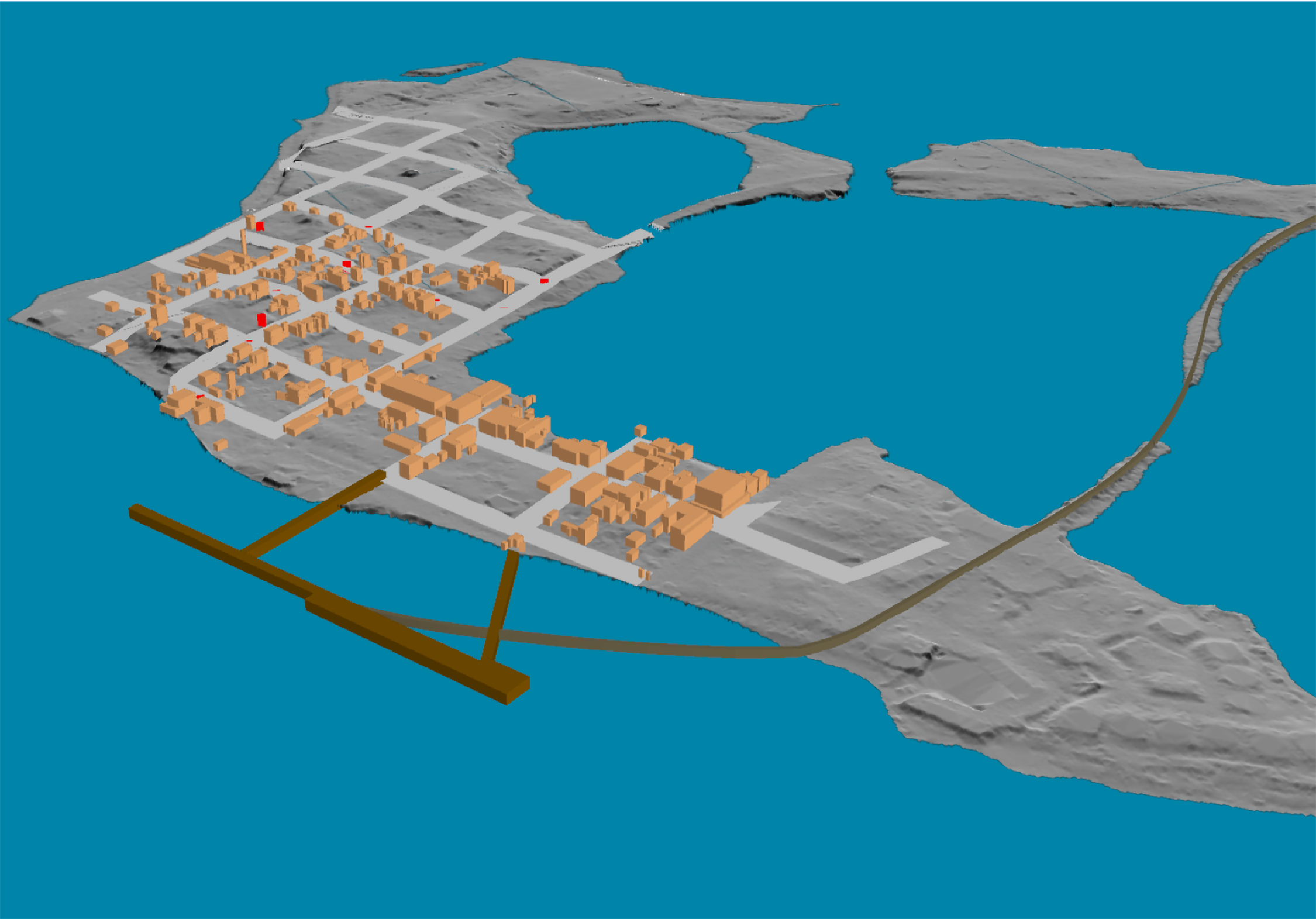
From here, Sassaman’s team will move forward with building out the digital re-creation of the island over these various time periods. The plan is to house the initial digital headset that will allow users to navigate the town in the Cedar Key Historical Society’s museum (opens in new tab), while remote users will be able to access a website to experience the walkthrough themselves.
Sassaman sees the potential for expanding the team’s use of technology to make this re-creation of Atsena Otie Key even more interactive, with an augmented reality version of the town built out so that visitors to the island can actually walk around and see what used to be there by just holding up their mobile devices.
While this augmented reality stage is still a while off, the creativity and willingness to engage with the public in such an innovate manner speaks to how important Sassaman feels this history is to our present times.
“History is the archive of human experiences that we use to shape our perception of where we are and where we’re going,” Sassaman said. “We need to mobilize these experiences and make them available — now.”
